Английский язык, 7 заданий: Текст Kinds of surveys
| Код | 218935 | ||
| Дата создания | 2019 | ||
| Страниц | 7 ( 14 шрифт, полуторный интервал ) | ||
|
Файлы
|
|||
|
Без ожидания: файлы доступны для скачивания сразу после оплаты.
Ручная проверка: файлы открываются и полностью соответствуют описанию.
|
|||
Образцы страниц развернуть (7)
Фрагмент работы для ознакомления
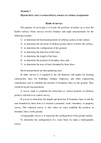
Задание 1
Прочитайте текст и попытайтесь понять его общее содержание
Kinds of surveys
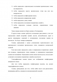
The purpose of surveying is to locate the positions of points on or near the Earth's surface. Some surveys involve distance and angle measurements for the following reasons:
- to determine the horizontal position of arbitrary points on the surface;
- to determine the elevation of arbitrary points above or below the surface;
- to determine the configuration of the ground;
- to determine the direction of the lines;
- to determine the length of the lines;
- to determine the position of boundary lines and...
- to determine the area of tracts bounded by these lines.
Such measurements are data gathering ones.
In other surveys it is required to lay off distances and angles for locating construction lines for buildings, bridges, highways and other engineering constitutions and to establish the position of boundary lines on the ground. They would be layout measurements.
A survey made to establish the horizontal or vertical position of arbitrary points is referred to as control survey.
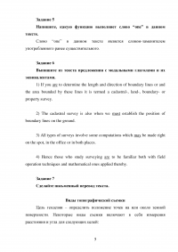
If you are to determine the length and direction of boundary lines or and the area bounded by these lines it is termed a cadastral-, land-, boundary- or property survey. The cadastral survey is also when we must establish the position of boundary lines on the ground.
A topographic survey is to represent the configuration of the ground surface.
To determine the configuration of a water body we make a hydrographic survey.
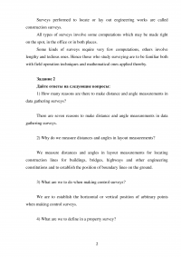
Surveys performed to locate or lay out engineering works are called construction surveys.
All types of surveys involve some computations which may be made right on the spot, in the office or in both places.
Some kinds of surveys require very few computations, others involve lengthy and tedious ones. Hence those who study surveying are to be familiar both with field operation techniques and mathematical ones applied thereby.
Задание 2
Дайте ответы на следующие вопросы:
1) How many reasons are there to make distance and angle measurements in data gathering surveys?
...
2) Why do we measure distances and angles in layout measurements?
...
3) What are we to do when making control surveys?
...
4) What are we to define in a property survey?
...
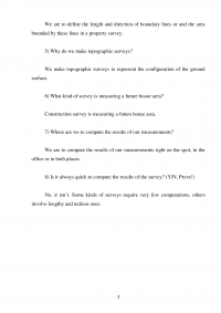
5) Why do we make topographic surveys?
...
6) What kind of survey is measuring a future house area?
...
7) Where are we to compute the results of our measurements?
...
8) Is it always quick to compute the results of the survey? (Y/N, Prove!)
...
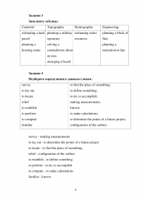
Задание 3
Заполните таблицу:
| Cadastral | Topographic | Hydrographic | Engineering |
| ... | ... | ... | ... |
Задание 4
Подберите определения к данным словам:
survey
to lay out
to locate
relief
to establish
to perform
to compute
familiar
...
Задание 5
Напишите, какую функцию выполняет слово “one” в данном тексте.
...
Задание 6
Выпишите из текста предложения с модальными глаголами и их эквивалентами.
Задание 7
Сделайте письменный перевод текста.
Виды топографической съемки
Цель геодезии – определить положение точек на или около земной поверхности. Некоторые виды съемки включают в себя измерения расстояния и угла для следующих целей:
...
